Pueblo Neighborhoods Project
May 12, 2014
Since writing my “Why Pueblo” blog post a couple years ago and my “4 C Factors Making Pueblo the Best Bargain in North America” post earlier this year, I’ve had a lot of people ask me what neighborhoods I recommend for renting or buying a home in Pueblo. I have several neighborhoods I typically recommend (e.g., Aberdeen, Belmont, El Camino, Mesa Junction, Sunset, etc) but none of them have formal definitions and none are tied to useful sources of data, like demographics from the Census Bureau.
So, I’ve decided to create a partition of Pueblo neighborhoods and I will document my progress here. I will also likely ask for input from current and former residents of Pueblo.
There are several efforts underway to crowd source neighborhood data. One of the first such attempts I have seen is an effort to map properties and neighborhoods in Detroit called Why Don’t We Own This, a very nice property portal with a focus on identifying and contextualizing the many distressed properties for sale in the city. A friend and colleague has a nice application allowing users to define custom neighborhoods in Portland, Seattle and Vancouver. The author acknowledges gleaning plenty of ideas and inspiration from Bostonography. More commercialized efforts to do similar work have been undertaken by Urban Mapping. And, of course, Google has neighborhood definitions included in their Maps service. I have no doubt that many other similar efforts are underway. Please leave a comment below if you’ve seen a worthy neighborhood mapping project I failed to mention.
I’ve made a rough first pass at creating Pueblo neighborhood definitions for a data analysis exercise in one of the Statistics courses I teach. This worked okay for the course but I would like to be able to readily tie each neighborhood to Census demographics as I mentioned above. Another consideration is spatial scale. I don’t want to leave out key neighborhoods but I want a manageable number of locations for analysis so results can be easily interpreted. Unfortunately, there are no perfectly suited existing geographical boundaries for this task.

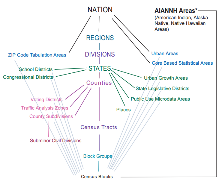
ZIP Codes don’t work because they are too large, combining too many neighborhoods. Same, of course, goes for County, CBSA and a few others. ZIP+4 might be a good size but demographic data must be interpolated for ZIP or ZIP+4 introducing error into any data analysis. Plus some ZIP codes are point locations, meaning the entire ZIP code is for one building or campus location. This complicates matters considerably and wouldn’t make for a terribly attractive methodology to replicate elsewhere.
That leaves Census Tracts and Block Groups. Block groups are small and each neighborhood definition would be comprised of several smaller Block Group units. Ultimately, this would probably result in the most accurate neighborhood shapes and sizes while still allowing aggregation of demographic data. But, it would take a lot more time to compile neighborhood boundaries and the underlying demographic data would always require data queries to maintain the relationship between each block group and its assigned neighborhood. Long term, it would be nice to see this work done at the Block Group level but, near term, I think Census Tracts will suffice for my purposes. The size and shape of various Census Tracts will be incompatible with some informal neighborhood boundaries. I can already see this to be the case in Pueblo but Census Tracts are ideal otherwise. There are 30-40 Census Tracts in the City of Pueblo, just about the right number to capture the many differences among various parts of the city. Each Census Tract is tied directly to a full suite of demographic data from the Census Bureau – no interpolation, aggregation or manipulation necessary. Census Tracts aggregate directly to the County level and Census Tracts have been in use by geographers, cartographers and GIS technicians for decades so the fundamental data layers and mapping tools are all in place.
1 Comment
[…] Previous post […]