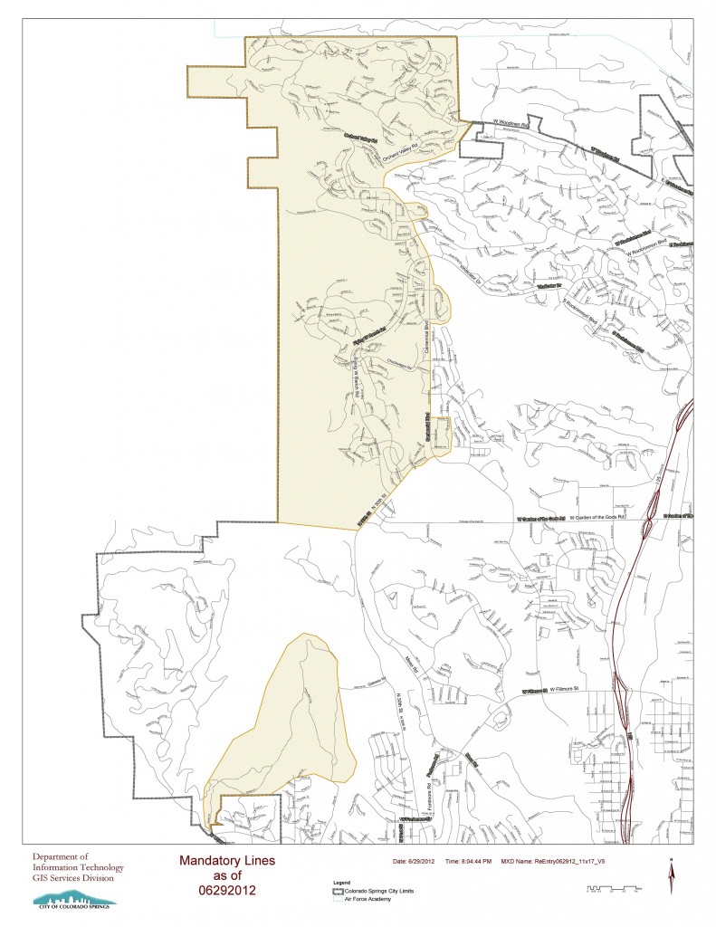
Waldo Canyon Fire Mandatory Evacuation Map
June 29, 2012
I was having trouble downloading the PDF version of this map so I’m posting a smaller jpg version here in hopes that it might help someone struggling to access this information. This map will be more difficult to read but you should be able to click on the image and then zoom in using browser controls. If you’re familiar with the Colorado Springs road network you should be able to identify your neighborhood. The shaded area is still under mandatory evacuation notice.
Big kudos to the Colorado Springs GIS department who must be working around the clock to keep up with demand for their mapping and analytical services.

4 Comments
I’m really impressed together with your writing skills and also with the format to your blog. Is that this a paid subject matter or did you customize it your self? Anyway stay up the excellent quality writing, it is uncommon to see a great weblog like this one nowadays..
Wow. Thanks for the kind words! I’ve written all the content myself (except for a few quotes here and there). Credit for visual layout/format goes to one of the premium WordPress themes and Charlie Dwyer at Long Tail Logic (http://www.longtaillogic.com/) who has been helping me navigate the social media universe. Thanks again for the encouragement!
Yes. Your blog is really impressing. I noticed you hold a PhD from the University of Oregon and you have a strong background in geo-spatial techniques. By the way, do you know where I could download the shapefile data for the evacuation map mentioned in your article? Thanks.
Thanks Dapeng! For a shapefile, I would try visiting this website: http://csfd.springsgov.com/. The site has the following contact info.
For Information Call:
Andrew Notbohm: 2012
Wildfire Mitigation Program Coordinator
719-385-7342
Fire Department Complex
375 Printers Parkway
Colorado Springs, CO
80910-3191
[email protected]
Good luck!